 The Seattle City Council is expected Tuesday to approve legislation expanding the city’s Real Time Crime Center with new cameras in Pike/Pine and the Central District plus expansion of the Seattle Police Department surveillance system to use select Seattle Department of Transportation traffic cameras in the program.
The council’s public safety committee including District 3 representative Joy Hollingsworth has signed off on the “surveillance technology implementation” plan. CHS reported here on final debate about data privacy and how the city says it will handle any potential legal wrangling with outside agencies like ICE.
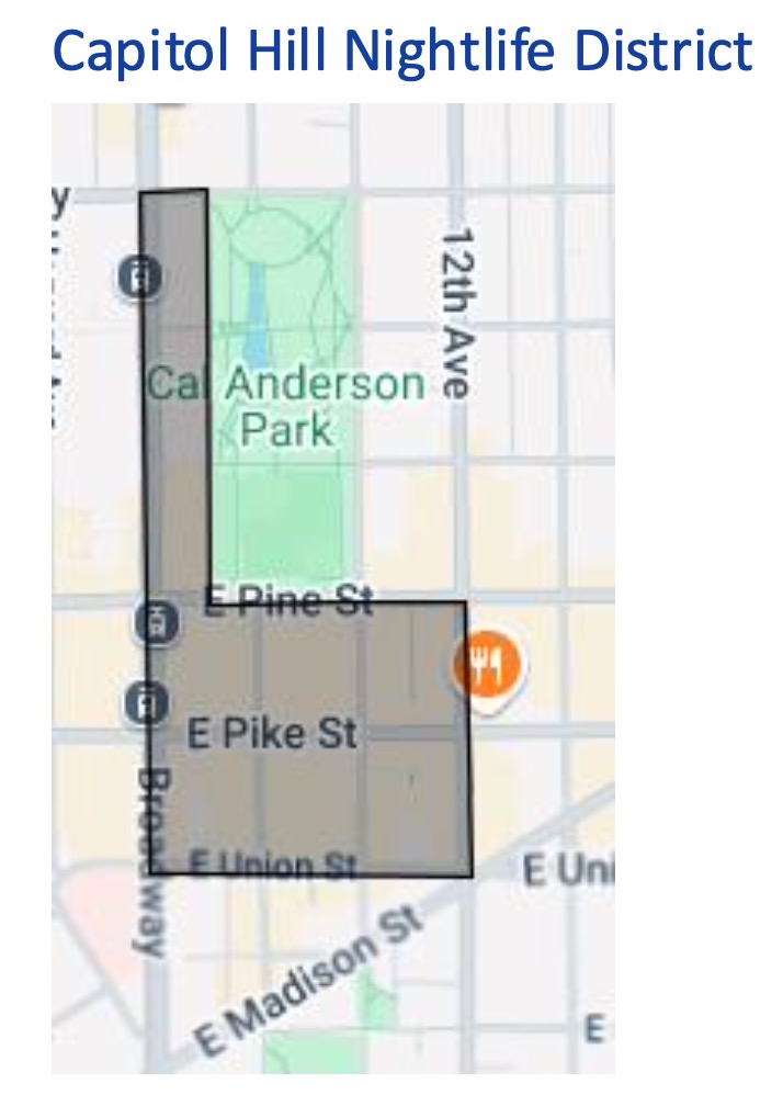
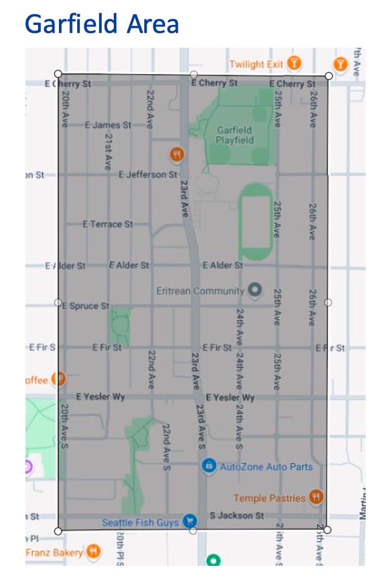
The legislation will expand the SPD Real Time Crime Center surveillance camera system to include the Capitol Hill nightlife core around E Pike and Cal Anderson Park and a major swath of the Central District from E Cherry to Jackson police officials say is necessary to prevent gun violence near Garfield High School.
The proposed SPD camera expansion would also include adding the installations to the city’s Stadium District around Lumen Field and T-Mobile park.
The city already operates more than 350 traffic cameras across its streets.
SPD’s current three-location RTCC system includes 57 cameras, the city says.
The proposed Capitol Hill boundaries would cover the core of the Pike/Pine neighborhood along E Pike and E Pine between Broadway and 12th Ave with a mapped extension along Nagle Place and Broadway north of the core all the way to Denny/E Barbara Bailey Way and the southern edge of Capitol Hill Station and its Sound Transit security camera installations. The camera zone would stretch to the backside of Pike/Pine along E Union.
The Nagle extension would cover an area troubled by nighttime violence, camping, and street disorder and represents a de facto inclusion of Cal Anderson Park’s western edge including Bobby Morris Playfield and the skate area, dodgeball and tennis courts, and basketball court.


In the Central District, the Harrell administration and Hollingsworth pushed for the camera system to be centered around safety at Garfield High School but with boundaries running from a block north of the school along E Cherry all the way to S Jackson. The western edge would include 20th Ave and the eastern edge would extend along 26th Ave.
The zone would include Garfield’s 23rd Ave campus, the Garfield Super Block area including the Garfield Community Center and sports fields, and the troubled parking lot at 23rd and Jackson.
The Capitol Hill system will cost around $400,000 to install and $35,000 a year to operate.
The Central District installation has a budget of $425,000 and also an estimated $35,000 in “ongoing annual costs.”
UPDATE: Mayoral candidate Katie Wilson has called on the council to reject the proposed expansions.
“Turning on more cameras won’t magically make our neighborhoods safer. But it will certainly make our neighbors more vulnerable,” Wilson says in a statement sent to media. “As the Trump administration escalates its attacks on immigrants, trans people, and big cities in general, we need to prioritize safety, not surveillance.”
In her statement, Wilson says the proposal “to expand and centralize surveillance” will make it “all too easy for the federal government to target Seattleites.”
Mayor Bruce Harrell has supported and helped shape the proposed expansions.
 $5 A MONTH TO HELP KEEP CHS PAYWALL-FREE
🌈🐣🌼🌷🌱🌳🌾🍀🍃🦔🐇🐝🐑🌞🌻
Subscribe to CHS to help us hire writers and photographers to cover the neighborhood. CHS is a pay what you can community news site with no required sign-in or paywall. To stay that way, we need you.
Become a subscriber to help us cover the neighborhood for $5 a month — or choose your level of support 👍


